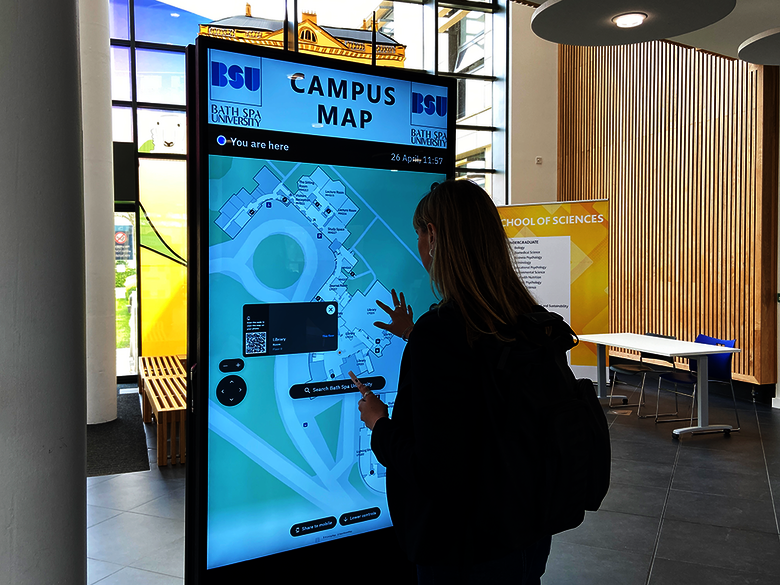
How Living Map is helping Bath Spa University to be more inclusive and accessible

Problem
Bath Spa University’s large, historic campus can be difficult to navigate.
Goal
To create an inclusive and accessible wayfinding tool that would make it easier for all students, especially freshers, as well as visitors and staff, to navigate the campus.
Approach
An interactive digital map offering routes that are stair-free , have lower control panels for easy use in wheelchairs, and have mobile compatibility, allowing students to navigate the campus in real-time from their phones. The map is integrated with the University's Accessable guide for additional accessibility features.
Living Map Solution:


“This solution will help all of our students— some of whom are disabled, neurodivergent, or have mental health challenges—navigate campus and settle into life at Bath Spa University."
Rebecca Schaaf
Pro-Vice-Chancellor Student Experience
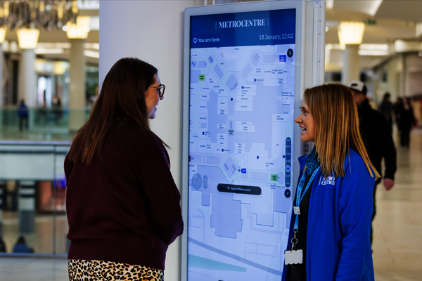
Enhanced Campus Navigation
Students, staff and visitors can easily find their way around campus, locating lecture halls, libraries, dining areas, residential areas and parking with ease. The interactive map provides real-time, step-by-step directions, minimising confusion and ensuring a smooth, stress-free experience.
Data-Driven Campus Optimisation
The digital map collects valuable data on foot traffic and facility usage, empowering universities to optimise their space, resource allocation, and staffing. These insights help improve campus efficiency, reduce congestion, and enhance the overall student experience.
Improved Inclusivity & Accessibility
Designed with accessibility at its core, the digital map highlights stair-free routes, lower control panles, elevators, accessible restrooms and other essential facilities. This ensures a seamless and inclusive experience for all students, staff, and visitors, regardless of their mobility.
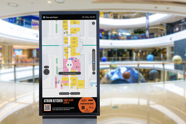
Seamless Wayfinding
Campus activity and event locations can change frequently, but real-time map updates keep everyone informed. Whether a lecture hall is reassigned or an event venue shifts, the interactive map instantly reflects changes, ensuring efficient navigation.
Smart Spaces case studies

Waltham Forest Case Study
A customised digital map to improve accessibility for all with content curated by Waltham Forest’s council, for digital distribution
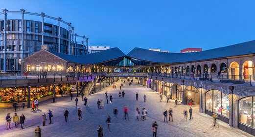
Kings Cross Case Study
King’s Cross, renowned for its diverse mix of shops, cafes, bars and restaurants nestled within its cobbled streets and brick arches, aimed to optimise visitor exploration.

City of Edmonton Case Study
Seeking to capture the dynamic and changing character of the city, Edmonton requested a digital map for residents and visitors that highlights the changing seasons.
Latest Smart Spaces news and resources

Request a demo
Experience the power of our mapping, wayfinding, and navigation technology for yourself. See how our software can enhance the customer experience in your facility.